
Streets drawn on a map are not permanent on a barrier island
by Dave Miller | Contributing Writer
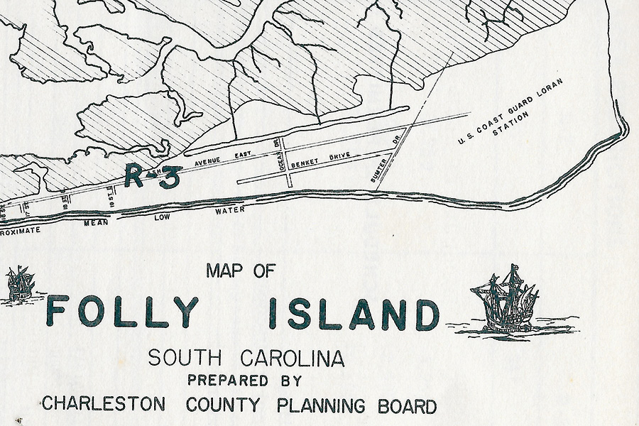
 The northeastern end of Folly offers one of the clearest examples of what shoreline retreat can do to streets, lots, and property lines. Historic plans show Benket Drive running parallel to and seaward of East Ashley Avenue, serving another row of oceanfront property.
But streets drawn on a map are not permanent on a barrier island. By about 1972, severe erosion had carried Benket Drive and much of the surrounding land into the Atlantic. The road disappeared, but its former route and the adjoining property boundaries remained in plats and legal records. According to local accounts, owners continued to hold—and pay taxes on—parcels that had become wet beach or submerged ground.
A street could therefore remain legally recognizable after the ocean had removed its pavement. Property lines could survive on paper after the corresponding dry land had disappeared.
Around 1986, shifting sands returned dry beach to portions of the area. The reappearance of sand did not immediately resolve what could be done with the former oceanfront parcels. It did, however, set the stage for a much larger change after the first federal renourishment.
Benket Drive became part of the island’s memory: a reminder that today’s oceanfront was not necessarily yesterday’s front row—and that land lost to the ocean could sometimes return.
Beginning Nov. 2, visit the Folly Beach History Museum at 55 Center St. to experience “Shifting Sands,” a new exhibit that traces the island’s ever-changing shoreline from the pre-Jetties 1800s to today. The museum is open from 10:30 a.m. to 2:30 p.m. on Monday, Tuesday, and Friday, and from 10:30 a.m. to 12:30 p.m. on the second and fourth Saturdays of each month.